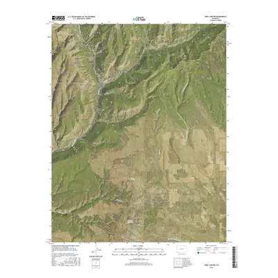
2016 Map of Trail Canyon
USGS Topo · Published 2016About this map
Mesa Verde National Park anchors the northwestern corner of this landscape, where the East Rim overlooks the deep descent into Mancos Canyon. The Mancos River carves a significant path through the center, separating the high elevation of Mesa Verde from the plateau of Lewis Mesa. This 2016 survey documents a network of county roads, including Co RD 41 and Co RD 115, that navigate the complex topography of canyons and draws like Swift Canyon and Silva Draw. Water management in this arid environment is evident through several named catchments, such as Upper Reservoir and Harrison Reservoir, which support the local ranching and agricultural needs of the Montezuma and La Plata County borderlands.
Find a feature on this map
40 named features on this map. Tap any name to fly to it.
Don’t see what you’re looking for? This feature index may not catch every label — zoom into the map to look around manually.
Map Details
Editions of this 2016 Trail Canyon Map
This is the sole edition of this map. No revisions or reprints were ever made.
Other maps of this area

1895 · La Plata
USGS Topo · 1:62,500

1897 · La Plata
USGS Topo · 1:62,500

1899 · La Plata
USGS Topo · 1:62,500

1908 · La Plata
USGS Topo · 1:62,500

1912 · Soda Canyon
USGS Topo · 1:62,500

1913 · Red Mesa
USGS Topo · 1:62,500

1915 · Soda Canyon
USGS Topo · 1:62,500

1956 · Cortez
USGS Topo · 1:250,000

1958 · Cortez
USGS Topo · 1:250,000

1959 · Cortez
USGS Topo · 1:250,000