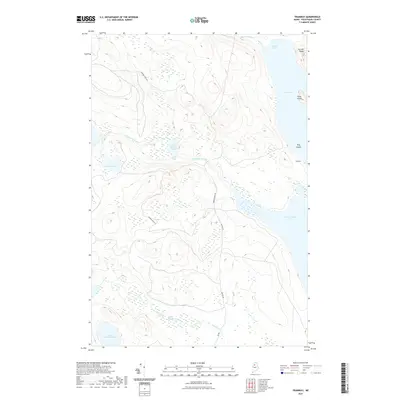
2021 Map of Tramway
USGS Topo · Published 2021About this map
Eagle Lake and Chamberlain Lake dominate the eastern edge of this Piscataquis County landscape, where the settlement of Tramway sits along the narrow passage between these two major water bodies. The terrain is defined by a dense network of water features, including the Allagash Stream which flows through Little Round Pond and over Little Allagash Falls. The map reveals the intricate hydrology of the Maine north woods, from the broad Upper Deadwater along Ellis Brook to isolated basins like Otter Pond and Little Shallow Lake.
Find a feature on this map
18 named features on this map. Tap any name to fly to it.
Don’t see what you’re looking for? This feature index may not catch every label — zoom into the map to look around manually.
Map Details
Editions of this 2021 Tramway Map
This is the sole edition of this map. No revisions or reprints were ever made.
Other maps of this area

1954 · Chesuncook
USGS Topo · 1:62,500

1954 · Caucomgomoc Lake
USGS Topo · 1:62,500

1954 · Churchill Lake
USGS Topo · 1:62,500

1954 · Allagash Lake
USGS Topo · 1:62,500

1954 · Presque Isle
USGS Topo · 1:250,000

1958 · Presque Isle
USGS Topo · 1:250,000

1958 · Chesuncook
USGS Topo · 1:62,500

1958 · Caucomgomoc Lake
USGS Topo · 1:62,500

1960 · Presque Isle
USGS Topo · 1:250,000

1961 · Allagash Lake
USGS Topo · 1:62,500