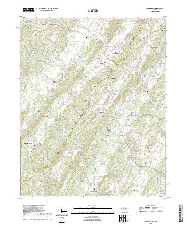
2022 Map of Tranquillity
USGS Topo · Published 2022About this map
McMinn Ridge and No Pone Ridge define the parallel northeast-southwest topography of this Tennessee landscape along the border of Meigs and McMinn Counties. The settlement pattern follows the fertile valleys between these ridges, anchored by small communities such as Tranquillity and Sewee. Water is central to the area's development, with Big Sewee Creek and Little Sewee Creek draining the lowlands, and numerous natural features like Lockmiller Springs and Thomas Spring scattered across the terrain.
Find a feature on this map
141 named features on this map. Tap any name to fly to it.
Don’t see what you’re looking for? This feature index may not catch every label — zoom into the map to look around manually.
Map Details
Editions of this 2022 Tranquillity Map
This is the sole edition of this map. No revisions or reprints were ever made.
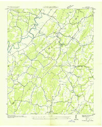
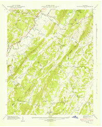
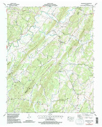
Historical Maps of Tranquillity Through Time
5 maps found