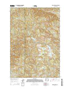
2014 Map of Trask Mountain
USGS Topo · Published 2014About this map
Trask Mountain dominates the northern reaches of this coastal range landscape, where the headwaters of several major river systems converge. The terrain is defined by a series of high ridges and deep drainages, including the N Yamhill River and the Nestucca River. A significant portion of the eastern section is managed as part of the Siuslaw National Forest, while human engineering is evident in the cluster of water management sites like McGuire Reservoir, Walker Cr Reservoir, and the uniquely named Such Joja Reservoir. Forest management and logistics are centered around Headquarters in the northwest, connected by a network of timber roads such as NW Meadowlake Rd and Camp Cooper Rd. Higher elevations are marked by prominent summits including Sheridan Peak and Bald Mtn, providing a clear view of the complex hydrology of Yamhill County.
Find a feature on this map
42 named features on this map. Tap any name to fly to it.
Don’t see what you’re looking for? This feature index may not catch every label — zoom into the map to look around manually.
Map Details
Editions of this 2014 Trask Mountain Map
This is the sole edition of this map. No revisions or reprints were ever made.
Other maps of this area

1942 · Ginger Peak
USGS Topo · 1:62,500

1942 · Sheridan
USGS Topo · 1:62,500

1942 · Spirit Mtn
USGS Topo · 1:62,500

1942 · Fairdale
USGS Topo · 1:62,500

1948 · Vancouver
USGS Topo · 1:250,000

1950 · Vancouver
USGS Topo · 1:250,000

1950 · Vancouver
USGS Topo · 1:250,000

1955 · Blaine
USGS Topo · 1:62,500

1955 · Fairdale
USGS Topo · 1:62,500

1955 · Grand Ronde
USGS Topo · 1:62,500