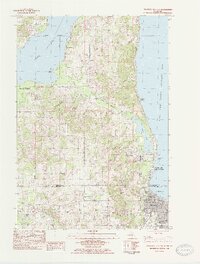
1983 Map of Traverse City SW
USGS Topo · Published 1984About this map
The West Arm Grand Traverse Bay shoreline anchors this 1980s portrait of the transition between the growing city and the surrounding fruit-growing and forested uplands. The northwestern corner of Traverse City is shown in detail, featuring the State Hospital, Central School, and the harbor area. Just north along the coast, Greilickville serves as a key coastal node, while the interior landscape is defined by the Leelanau Transit Company rail line and family-named locations like Heimforth and Hatchs.
Find a feature on this map
77 named features on this map. Tap any name to fly to it.
Don’t see what you’re looking for? This feature index may not catch every label — zoom into the map to look around manually.
Map Details
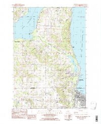
Editions of this 1983 Traverse City SW Map
2 editions found
Other maps of this area

1954 · Traverse City
USGS Topo · 1:250,000

1956 · Kingsley
USGS Topo · 1:62,500

1956 · Thompsonville
USGS Topo · 1:62,500

1957 · Traverse City
USGS Topo · 1:62,500

1957 · Maple City
USGS Topo · 1:62,500

1958 · Traverse City
USGS Topo · 1:250,000

1976 · Thompsonville NE
USGS Topo · 1:24,000

1983 · Maple City
USGS Topo · 1:24,000

1983 · Traverse City SE
USGS Topo · 1:25,000

1983 · Traverse City
USGS Topo · 1:100,000
Featured Places
- Garfield Township, MI
- Traverse City, MI
- Long Lake Township, MI
- Elmwood Charter Township, MI
- Greilickville, Elmwood Charter Township