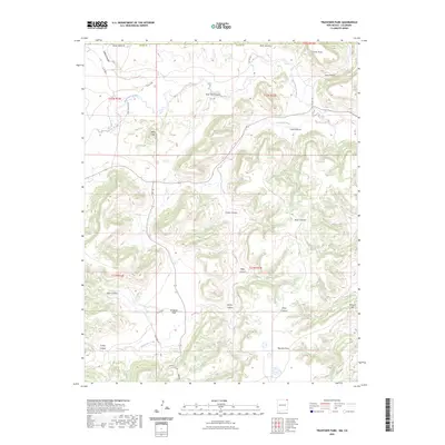
2023 Map of Travesser Park
USGS Topo · Published 2023About this map
Travesser Park and the surrounding canyonlands of Union County are defined by a network of seasonal watercourses and prominent mesas. The Dry Cimarron River cuts across the northern edge of this high-plains landscape, while Travesser Creek winds through the central and southern sections, creating a complex series of drainage features. These include Cooty Canyon, Gripe Canyon, and Dickey Canyon, which dissect the high ground. Notable elevations like Jesus Mesa and Baldy Hill provide distinct vertical relief against the alluvial flats. Local ranching and transportation history is evidenced by county roads such as Co RD c040 and Co RD b042, which trace the natural contours of the canyons to connect this isolated portion of the New Mexico borderlands.
Find a feature on this map
30 named features on this map. Tap any name to fly to it.
Don’t see what you’re looking for? This feature index may not catch every label — zoom into the map to look around manually.
Map Details
Editions of this 2023 Travesser Park Map
This is the sole edition of this map. No revisions or reprints were ever made.
Other maps of this area

1891 · Mesa De Maya
USGS Topo · 1:125,000

1892 · Mt Carrizo
USGS Topo · 1:125,000

1893 · Mesa de Maya
USGS Topo · 1:125,000

1954 · Dalhart
USGS Topo · 1:250,000

1955 · La Junta
USGS Topo · 1:250,000

1958 · La Junta
USGS Topo · 1:250,000

1958 · Dalhart
USGS Topo · 1:250,000

1962 · Dalhart
USGS Topo · 1:250,000

1968 · La Junta
USGS Topo · 1:250,000

1972 · Travesser Park
USGS Topo · 1:24,000