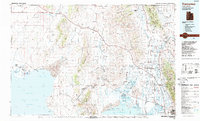
1989 Map of Tremonton
USGS Topo · Published 1989About this map
The Golden Spike National Historic Site stands as a central landmark in this 1989 portrait of Box Elder County, where the desert flats meet the northern reaches of the Great Salt Lake. This landscape is defined by the transition from the arid Hansel Valley and the North Promontory Mountains to the fertile Malad Valley irrigation systems. The eastern edge is anchored by the dense settlements of Tremonton, Garland, and Brigham City along the Bear River, illustrating the agricultural development of the region during the late 20th century.
Find a feature on this map
82 named features on this map. Tap any name to fly to it.
Don’t see what you’re looking for? This feature index may not catch every label — zoom into the map to look around manually.
Map Details
Editions of this 1989 Tremonton Map
2 editions found
Other maps of this area

1914 · Logan
USGS Topo · 1:125,000

1915 · Preston
USGS Topo · 1:96,000

1916 · Logan
USGS Topo · 1:125,000

1918 · Preston
USGS Topo · 1:125,000

1954 · Whistler Canal
USGS Topo · 1:24,000

1954 · Public Shooting Grounds
USGS Topo · 1:24,000

1954 · Pocatello
USGS Topo · 1:250,000

1954 · Ogden
USGS Topo · 1:250,000

1954 · Brigham City
USGS Topo · 1:250,000

1955 · Mantua
USGS Topo · 1:24,000