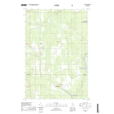
2019 Map of Trenary
USGS Topo · Published 2019About this map
Trenary stands as the central hub of this landscape at the intersection of several regional routes, surrounded by the dense timberlands of the Hiawatha National Forest. The geography is defined by a complex network of waterways, most notably the Whitefish Wild and Scenic River and the West Branch Whitefish River. Local history and genealogy researchers will find the Mathias Township Cem and Trenary Cem positioned just north of the town center, providing a fixed point for tracing early residents of Mathias Township. The southern portion of the map transitions across the boundary from Alger County into Delta County, where the terrain becomes increasingly influenced by the drainage of Casey Cr and the Whitefish River Canoe W Br. The grid of local roads, such as Co Hwy 101 and Eben-Trenary Rd, highlights the township's rural development patterns and access points into the surrounding protected wilderness areas.
Find a feature on this map
55 named features on this map. Tap any name to fly to it.
Don’t see what you’re looking for? This feature index may not catch every label — zoom into the map to look around manually.
Map Details
Editions of this 2019 Trenary Map
This is the sole edition of this map. No revisions or reprints were ever made.
Other maps of this area

1932 · Trenary SW
USGS Topo · 1:31,680

1932 · Rock NE
USGS Topo · 1:31,680

1932 · Skandia SE
USGS Topo · 1:31,680

1932 · Trenary SE
USGS Topo · 1:31,680

1932 · Rock SE
USGS Topo · 1:31,680

1958 · Trenary
USGS Topo · 1:62,500

1958 · Au Train
USGS Topo · 1:62,500

1958 · Skandia
USGS Topo · 1:62,500
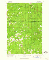
1958 · Rock
USGS Topo · 1:62,500

1958 · Marquette
USGS Topo · 1:250,000
Featured Places
- Mathias Township, MI
- Trenary, MI
- Limestone Township, MI
- Masonville Township, MI
- Maple Ridge Township, MI