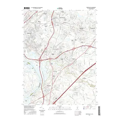
2016 Map of Trenton East
USGS Topo · Published 2016About this map
The Delaware River and the historic Delaware and Raritan Canal define the southwestern edge of this landscape, tracing the border between Pennsylvania and New Jersey. Industrial and residential growth radiates from Trenton toward established communities like Mercerville, White Horse, and Yardville. The map captures a complex network of transportation, where the New Jersey Tpke and several major highways intersect the older, winding paths of Crosswicks Creek and Doctors Creek.
Find a feature on this map
62 named features on this map. Tap any name to fly to it.
Don’t see what you’re looking for? This feature index may not catch every label — zoom into the map to look around manually.
Map Details
Editions of this 2016 Trenton East Map
This is the sole edition of this map. No revisions or reprints were ever made.
Other maps of this area

1888 · Bordentown
USGS Topo · 1:62,500

1888 · Princeton
USGS Topo · 1:62,500

1890 · Lambertville
USGS Topo · 1:62,500

1890 · Burlington
USGS Topo · 1:62,500

1891 · Lambertville
USGS Topo · 1:62,500

1893 · Bordentown
USGS Topo · 1:62,500

1893 · Burlington
USGS Topo · 1:62,500

1894 · Princeton
USGS Topo · 1:62,500

1894 · Lambertville
USGS Topo · 1:62,500

1904 · Burlington
USGS Topo · 1:62,500