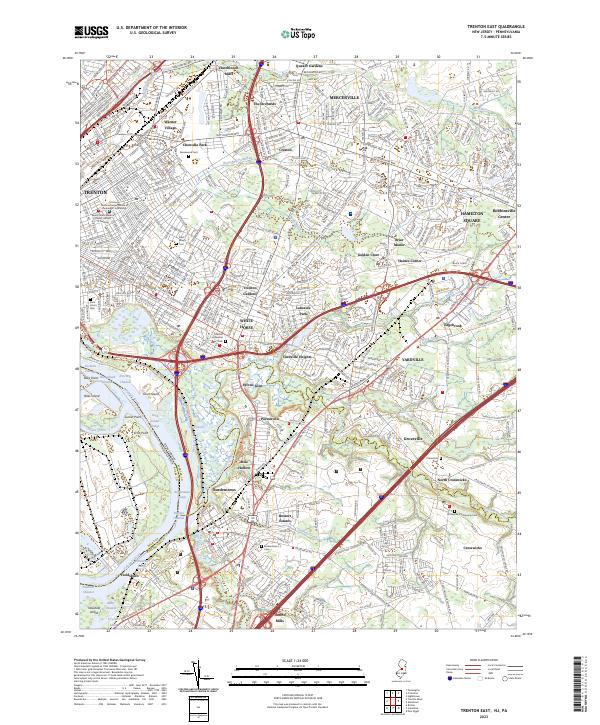
2023 Map of Trenton East
USGS Topo · Published 2023About this map
Trenton and its southeastern suburbs spread across this 2023 landscape, where the Delaware River meets a complex network of creeks and historic transportation corridors. The map details a densely settled region transitioning from the urban industrial legacy of the riverfront to the residential growth of Hamilton Square and Mercerville. Significant genealogical landmarks are visible throughout, including Greenwood Cem and Saint Mary's Cem, alongside older industrial markers like Hutchinson Mills and Dunns Mills.
Find a feature on this map
75 named features on this map. Tap any name to fly to it.
Don’t see what you’re looking for? This feature index may not catch every label — zoom into the map to look around manually.
Map Details
Editions of this 2023 Trenton East Map
This is the sole edition of this map. No revisions or reprints were ever made.
Other maps of this area

1888 · Bordentown
USGS Topo · 1:62,500

1888 · Princeton
USGS Topo · 1:62,500

1890 · Lambertville
USGS Topo · 1:62,500

1890 · Burlington
USGS Topo · 1:62,500

1891 · Lambertville
USGS Topo · 1:62,500

1893 · Bordentown
USGS Topo · 1:62,500

1893 · Burlington
USGS Topo · 1:62,500

1894 · Princeton
USGS Topo · 1:62,500

1894 · Lambertville
USGS Topo · 1:62,500

1904 · Burlington
USGS Topo · 1:62,500