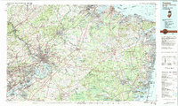
1982 Map of Trenton
USGS Topo · Published 1983About this map
Trenton and the surrounding central New Jersey corridor appear here in a period of significant suburban and industrial density. The New Jersey State House stands as a focal point in the capital, while the Delaware River separates the metropolitan area from Morrisville and Levittown in Pennsylvania. This 1982 compilation illustrates the massive transportation network of the New Jersey Turnpike and Garden State Parkway that facilitated the growth of these townships.
Find a feature on this map
234 named features on this map. Tap any name to fly to it.
Don’t see what you’re looking for? This feature index may not catch every label — zoom into the map to look around manually.
Map Details
Editions of this 1982 Trenton Map
This is the sole edition of this map. No revisions or reprints were ever made.
Other maps of this area

1884 · Whitings
USGS Topo · 1:62,500

1888 · Plainfield
USGS Topo · 1:62,500

1888 · Bordentown
USGS Topo · 1:62,500

1888 · Pemberton
USGS Topo · 1:62,500

1888 · Barnegat
USGS Topo · 1:62,500

1888 · New Brunswick
USGS Topo · 1:62,500

1888 · Mount Holly
USGS Topo · 1:62,500

1888 · Princeton
USGS Topo · 1:62,500

1888 · Asbury Park
USGS Topo · 1:62,500

1888 · Cassville
USGS Topo · 1:62,500