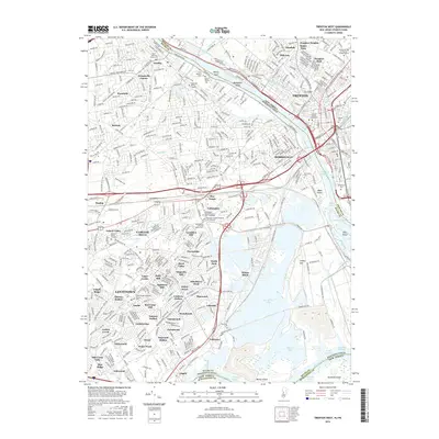
2016 Map of Trenton West
USGS Topo · Published 2016About this map
The Delaware River defines the border between Pennsylvania and New Jersey, cutting a wide path between the industrial heart of Trenton and the sprawling mid-century residential developments of Bucks County. This landscape is a complex mosaic of planned post-war communities like Levittown and Fairless Hills, where many neighborhoods are distinctively named, such as Magnolia Hill, Holly Hill, and Red Cedar Hill. Amidst this modern suburban growth, deep historical roots remain visible through numerous Quaker and family burial sites, including the Fallsington Friends Meeting Cem - Orthodox and the Morris Family Cem. The river itself is punctuated by significant islands like Rotary Island and Biles Island, while the Delaware and Raritan Canal traces the New Jersey bank. This 2016 survey documents how major infrastructure like Interstate 95 and U S Highway 1 has reshaped the movement and settlement patterns of this corridor.
Find a feature on this map
110 named features on this map. Tap any name to fly to it.
Don’t see what you’re looking for? This feature index may not catch every label — zoom into the map to look around manually.
Map Details
Editions of this 2016 Trenton West Map
This is the sole edition of this map. No revisions or reprints were ever made.
Other maps of this area

1888 · Bordentown
USGS Topo · 1:62,500

1888 · Princeton
USGS Topo · 1:62,500

1890 · Lambertville
USGS Topo · 1:62,500

1890 · Burlington
USGS Topo · 1:62,500

1891 · Lambertville
USGS Topo · 1:62,500

1893 · Bordentown
USGS Topo · 1:62,500

1893 · Burlington
USGS Topo · 1:62,500

1894 · Princeton
USGS Topo · 1:62,500

1894 · Lambertville
USGS Topo · 1:62,500

1904 · Burlington
USGS Topo · 1:62,500
Featured Places
- Hamilton Township, NJ
- Trenton, NJ
- Levittown, Bristol Township
- Middletown Township, PA
- Ewing Township, NJ