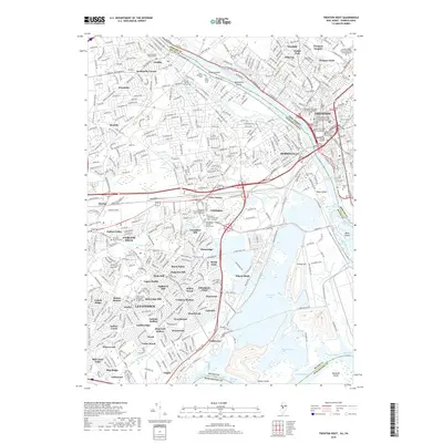
2019 Map of Trenton West
USGS Topo · Published 2019About this map
The Delaware River forms a complex borderland here, where the dense suburban blocks of Levittown and Fairless Hills meet the industrial and civic heart of Trenton and Morrisville. This modern survey reveals a landscape deeply layered with historical roots, particularly through its religious and burial sites. The Quaker heritage of the region is preserved at the Fallsington Friends Meeting Cem - Orthodox and the Fallsington Friends Meeting Cem - Hicksite. Further north, Yardley and Scammells Corner sit near the historic Delaware and Raritan Canal. To the south, the massive industrial footprint is balanced by expansive water bodies like Van Sciver Lake and Manor Lake, while the river itself is punctuated by landmarks such as Rotary Island and Newbold Island. The map meticulously details the evolution of planned residential neighborhoods, showing named sections from Appletree Hill to Cobalt Ridge.
Find a feature on this map
116 named features on this map. Tap any name to fly to it.
Don’t see what you’re looking for? This feature index may not catch every label — zoom into the map to look around manually.
Map Details
Editions of this 2019 Trenton West Map
This is the sole edition of this map. No revisions or reprints were ever made.
Other maps of this area

1888 · Bordentown
USGS Topo · 1:62,500

1888 · Princeton
USGS Topo · 1:62,500

1890 · Lambertville
USGS Topo · 1:62,500

1890 · Burlington
USGS Topo · 1:62,500

1891 · Lambertville
USGS Topo · 1:62,500

1893 · Bordentown
USGS Topo · 1:62,500

1893 · Burlington
USGS Topo · 1:62,500

1894 · Princeton
USGS Topo · 1:62,500

1894 · Lambertville
USGS Topo · 1:62,500

1904 · Burlington
USGS Topo · 1:62,500
Featured Places
- Hamilton Township, NJ
- Trenton, NJ
- Levittown, Bristol Township
- Middletown Township, PA
- Ewing Township, NJ