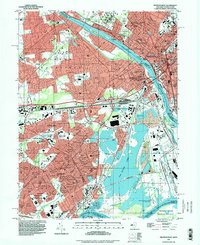
1995 Map of Trenton West
USGS Topo · Published 1998About this map
Trenton and Morrisville anchor this mid-1990s survey, illustrating the dense urban development along the Delaware River corridor where New Jersey and Pennsylvania meet. The map reveals the extensive residential growth of Levittown and Fairless Hills, planned communities that reshaped the post-war landscape of Bucks County. A distinct industrial legacy is visible in the massive excavation of the Sand and Gravel Pit near Tullytown, which eventually formed the sprawling Van Sciver Lake. Historic institutional presence is marked by the State Hospital and the Courthouse in the state capital, while the preservation of the past is secured at Pennsbury Manor State Park on the riverbank. This edition captures the infrastructure of the late twentieth century, showing the Conrail rail lines and the Lincoln Highway navigating the transition from historic river crossings to modern suburban thoroughfares.
Find a feature on this map
57 named features on this map. Tap any name to fly to it.
Don’t see what you’re looking for? This feature index may not catch every label — zoom into the map to look around manually.
Map Details
Editions of this 1995 Trenton West Map
This is the sole edition of this map. No revisions or reprints were ever made.
Other maps of this area

1888 · Bordentown
USGS Topo · 1:62,500

1888 · Princeton
USGS Topo · 1:62,500

1890 · Lambertville
USGS Topo · 1:62,500

1890 · Burlington
USGS Topo · 1:62,500

1891 · Lambertville
USGS Topo · 1:62,500

1893 · Bordentown
USGS Topo · 1:62,500

1893 · Burlington
USGS Topo · 1:62,500

1894 · Princeton
USGS Topo · 1:62,500

1894 · Lambertville
USGS Topo · 1:62,500

1904 · Burlington
USGS Topo · 1:62,500
Featured Places
- Hamilton Township, NJ
- Trenton, NJ
- Levittown, Bristol Township
- Middletown Township, PA
- Ewing Township, NJ