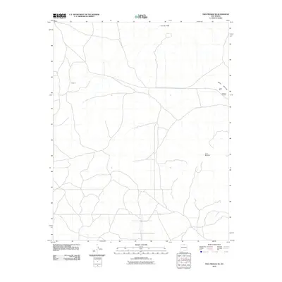
2010 Map of Tres Piedras NE
USGS Topo · Published 2010About this map
Cerro de la Olla and Cerro Montoso dominate this high-altitude landscape in northern Taos County. The terrain is defined by volcanic peaks and the sprawling road networks that connect the settlement of Sandoval to the surrounding high country. To the northeast, the presence of the United Mine and the Mickelsen Prospect along the slopes of Brushy Mountain indicates a history of mineral exploration in the region. This 2010 topographic record provides a detailed look at the rural infrastructure and land use patterns of the early 21st century, showing a mix of established routes and local trails that traverse the open basins between the distinct volcanic domes.
Find a feature on this map
6 named features on this map. Tap any name to fly to it.
Don’t see what you’re looking for? This feature index may not catch every label — zoom into the map to look around manually.
Map Details
Editions of this 2010 Tres Piedras NE Map
This is the sole edition of this map. No revisions or reprints were ever made.
Other maps of this area

1954 · Raton
USGS Topo · 1:250,000

1958 · Raton
USGS Topo · 1:250,000

1963 · Arroyo Hondo
USGS Topo · 1:24,000

1963 · Tres Piedras NE
USGS Topo · 1:24,000

1963 · Cerro De La Olla
USGS Topo · 1:24,000

1963 · Sunshine
USGS Topo · 1:24,000

1963 · Cerro De Los Taoses
USGS Topo · 1:24,000
1963 · La Segita Peaks
USGS Topo · 1:24,000

1963 · Guadalupe Mountain
USGS Topo · 1:24,000
1963 · Petaca Peak
USGS Topo · 1:24,000