
1963 Map of Sunshine
USGS Topo · Published 1967About this map
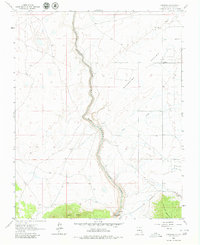
Sunshine Valley dominates this high-altitude landscape of northern New Mexico, where the massive rift of the Rio Grande Canon Del cuts a deep gorge through the basalt plateau. The small community of Sunshine and the nearby Sunshine Valley Cem sit at the valley edge, illustrating the sparse settlement patterns of Taos County in the early 1960s. To the south, the terrain rises sharply toward the forested slopes of Guadalupe Mountain and the distinctive peak of Cerro Chiflo. Water management is central to the area's geography, evidenced by a series of irrigation channels such as Ditch No 1 and Ditch No 2 that divert flow from the peaks. Near the canyon floor, a solitary Footbridge and the Sheep Crossing Campground indicate historic access points for livestock and travelers crossing the Rio Grande.
Find a feature on this map
15 named features on this map. Tap any name to fly to it.
Don’t see what you’re looking for? This feature index may not catch every label — zoom into the map to look around manually.
Map Details
Editions of this 1963 Sunshine Map
2 editions found
Other maps of this area

1954 · Raton
USGS Topo · 1:250,000

1958 · Raton
USGS Topo · 1:250,000

1963 · Costilla
USGS Topo · 1:24,000

1963 · Tres Piedras NE
USGS Topo · 1:24,000

1963 · Cerro De La Olla
USGS Topo · 1:24,000

1963 · Cerro
USGS Topo · 1:24,000

1963 · Ute Mountain
USGS Topo · 1:24,000
1963 · La Segita Peaks NE
USGS Topo · 1:24,000

1963 · Questa
USGS Topo · 1:24,000

1963 · Guadalupe Mountain
USGS Topo · 1:24,000