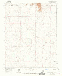
1963 Map of La Segita Peaks NE
USGS Topo · Published 1967About this map
Water management in this high-desert borderland is anchored by the Valley Ditch, which follows the contours of the northern terrain across the Colorado New Mexico line. The landscape is primarily defined by its drainage patterns and isolated water sources, such as a lone Well situated in the northeast. This 1963 survey captures the area as a rural boundary zone where the borders of Conejos County and Taos County meet at the state line. The lack of concentrated settlements or industrial infrastructure suggests a region dedicated to range or water rights management during the mid-twentieth century, with the ditch serving as the primary evidence of human modification to the natural landscape.
Find a feature on this map
4 named features on this map. Tap any name to fly to it.
Don’t see what you’re looking for? This feature index may not catch every label — zoom into the map to look around manually.
Map Details
Editions of this 1963 La Segita Peaks NE Map
This is the sole edition of this map. No revisions or reprints were ever made.
Other maps of this area

1954 · Raton
USGS Topo · 1:250,000

1954 · Trinidad
USGS Topo · 1:250,000

1955 · Trinidad
USGS Topo · 1:250,000

1958 · Raton
USGS Topo · 1:250,000

1958 · Trinidad
USGS Topo · 1:250,000

1959 · Trinidad
USGS Topo · 1:250,000

1963 · Pinabetoso Peaks
USGS Topo · 1:24,000

1963 · Cerro De La Olla
USGS Topo · 1:24,000

1963 · Ute Mountain
USGS Topo · 1:24,000

1963 · Sunshine
USGS Topo · 1:24,000