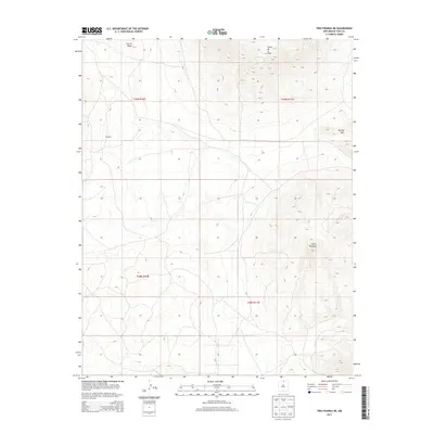
2013 Map of Tres Piedras NE
USGS Topo · Published 2013About this map
Cerro de la Olla and Cerro Montoso dominate this Taos County landscape, where volcanic features and high-altitude terrain define the local topography. This 2013 survey by the U.S. Geological Survey illustrates the transition from the basaltic shield of the Taos Plateau to prominent volcanic cones. The settlement of Sandoval is documented here, positioned within the Public Land Survey System grids of t29n r10e and t29n r11e. The map serves as a record of land management and natural landmarks, including Brushy Mtn and Cerrito Negro, providing essential geographic context for this northern New Mexico region during the early twenty-first century.
Find a feature on this map
9 named features on this map. Tap any name to fly to it.
Don’t see what you’re looking for? This feature index may not catch every label — zoom into the map to look around manually.
Map Details
Editions of this 2013 Tres Piedras NE Map
This is the sole edition of this map. No revisions or reprints were ever made.
Other maps of this area

1954 · Raton
USGS Topo · 1:250,000

1958 · Raton
USGS Topo · 1:250,000

1963 · Arroyo Hondo
USGS Topo · 1:24,000

1963 · Tres Piedras NE
USGS Topo · 1:24,000

1963 · Cerro De La Olla
USGS Topo · 1:24,000

1963 · Sunshine
USGS Topo · 1:24,000

1963 · Cerro De Los Taoses
USGS Topo · 1:24,000
1963 · La Segita Peaks
USGS Topo · 1:24,000

1963 · Guadalupe Mountain
USGS Topo · 1:24,000
1963 · Petaca Peak
USGS Topo · 1:24,000