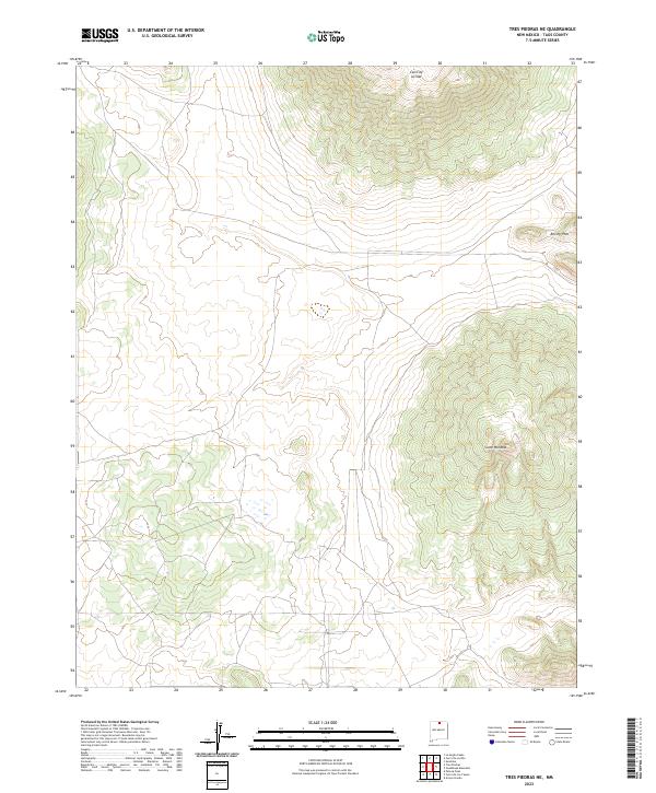
2023 Map of Tres Piedras NE
USGS Topo · Published 2023About this map
Río Grande del Norte National Monument covers the expansive northern New Mexico terrain of the Taos plateau, where high volcanic peaks rise above the high-altitude sagebrush plains. This landscape is defined by massive shield volcanoes and cinder cones, most notably the prominent Cerro de la Olla in the north and Cerro Montoso to the southeast. These geological features create significant relief against the surrounding basin, with Brushy Mtn marking the eastern edge of the quadrangle. The map details the complex topography of these volcanic landforms within the national monument, providing an essential resource for understanding the volcanic history and protected natural heritage of Taos County.
Find a feature on this map
8 named features on this map. Tap any name to fly to it.
Don’t see what you’re looking for? This feature index may not catch every label — zoom into the map to look around manually.
Map Details
Editions of this 2023 Tres Piedras NE Map
This is the sole edition of this map. No revisions or reprints were ever made.
Other maps of this area

1954 · Raton
USGS Topo · 1:250,000

1958 · Raton
USGS Topo · 1:250,000

1963 · Arroyo Hondo
USGS Topo · 1:24,000

1963 · Tres Piedras NE
USGS Topo · 1:24,000

1963 · Cerro De La Olla
USGS Topo · 1:24,000

1963 · Sunshine
USGS Topo · 1:24,000

1963 · Cerro De Los Taoses
USGS Topo · 1:24,000
1963 · La Segita Peaks
USGS Topo · 1:24,000

1963 · Guadalupe Mountain
USGS Topo · 1:24,000
1963 · Petaca Peak
USGS Topo · 1:24,000