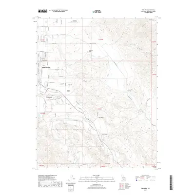
2018 Map of Tres Pinos
USGS Topo · Published 2018About this map
Hollister anchors the western edge of this landscape, where the residential grids of the city transition into the productive agricultural lands of the Hollister Valley. The terrain rises sharply to the east into the Diablo Range, defined by the deep contours of Arroyo Hondo and the prominent Swanson Bluff. This 2018 survey captures the interface between modern development in Ridgemark and the older agricultural character of the Santa Ana Valley. The San Benito River and Tres Pinos Creek snake through the valley floor, providing the primary drainage for the surrounding Diablo Hills. Small-scale aviation history is noted at the Christensen Ranch Airport near the northern boundary, while the historic settlement of Tres Pinos sits at a strategic junction where the creek and river corridors converge. The map provides an exacting look at the modern road network, from major arteries like Santa Ana Valley Rd to the suburban street names on the Hollister fringe.
Find a feature on this map
72 named features on this map. Tap any name to fly to it.
Don’t see what you’re looking for? This feature index may not catch every label — zoom into the map to look around manually.
Map Details
Editions of this 2018 Tres Pinos Map
This is the sole edition of this map. No revisions or reprints were ever made.
Other maps of this area

1919 · San Benito
USGS Topo · 1:62,500

1919 · Hollister
USGS Topo · 1:48,000

1921 · Gonzales
USGS Topo · 1:62,500

1921 · Hollister
USGS Topo · 1:62,500

1922 · Quien Sabe
USGS Topo · 1:62,500

1923 · Hollister
USGS Topo · 1:62,500

1931 · San Benito
USGS Topo · 1:62,500

1940 · Hollister
USGS Topo · 1:62,500

1940 · Quien Sabe
USGS Topo · 1:62,500

1940 · San Benito
USGS Topo · 1:62,500