2023 Map of Trevorton
USGS Topo · Published 2023About this map
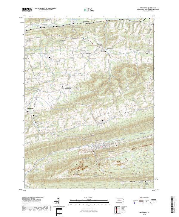
Trevorton sits at the base of Little Mountain and Big Mountain, serving as a focal point for the coal-bearing ridges of southern Northumberland County. The landscape is defined by the sharp, linear valleys of Zerbe Run and Little Shamokin Creek, which historically dictated the paths of transit and settlement in this corner of Pennsylvania. To the north, the terrain softens into the agricultural crossroads of Seven Points, Augustaville, and Snydertown, where small rural communities are clustered around long-standing local institutions.
Find a feature on this map
91 named features on this map. Tap any name to fly to it.
Don’t see what you’re looking for? This feature index may not catch every label — zoom into the map to look around manually.
Map Details
Editions of this 2023 Trevorton Map
This is the sole edition of this map. No revisions or reprints were ever made.
Historical Maps of Yordy Through Time
Featured Locations
- West Cameron Township, PA
- Rockefeller Township, PA
- Shamokin Township, PA
- Coal Township, PA
- Dunkelbergers, Little Mahanoy Township