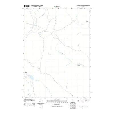
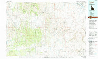
2010 Map of Triangle Reservoir
USGS Topo · Published 2010About this map
The settlement of Triangle serves as a lone outpost in this high-desert Owyhee County landscape, where water management is central to life on the land. A series of small-scale infrastructure projects, including Nettleton Dam, Rock Creek Dam, and Louisa Creek Dam, illustrate the critical importance of capturing seasonal flows from drainages like Rock Creek and Louisa Creek. The terrain is defined by a network of ephemeral and perennial watercourses that carve through the high plateaus, leading from the heights of Toy Mountain down into Cow Valley and along the winding North Fork Castle Creek.
Find a feature on this map
19 named features on this map. Tap any name to fly to it.
Don’t see what you’re looking for? This feature index may not catch every label — zoom into the map to look around manually.
Map Details
Editions of this 2010 Triangle Reservoir Map
This is the sole edition of this map. No revisions or reprints were ever made.
Other maps of this area

1955 · Jordan Valley
USGS Topo · 1:250,000

1957 · Jordan Valley
USGS Topo · 1:250,000

1958 · Jordan Valley
USGS Topo · 1:250,000

1965 · Triangle
USGS Topo · 1:62,500
1972 · Pixley Basin
USGS Topo · 1:24,000
1972 · Antelope Spring
USGS Topo · 1:24,000
1972 · Clover Mtn
USGS Topo · 1:24,000

1973 · Hurry Up Creek
USGS Topo · 1:24,000

1973 · Wickiup Creek
USGS Topo · 1:24,000
1990 · Triangle
USGS Topo · 1:100,000