
1973 Map of Wickiup Creek
USGS Topo · Published 1977About this map
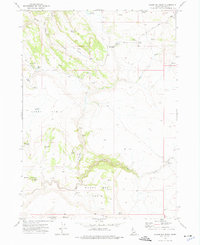
Rose Ridge and Combination Ridge dominate this high-desert Owyhee County landscape, where the drainage patterns reveal a complex network of seasonal water sources and valleys. The area is defined by its numerous springs, such as Long Valley Spring and Rose Creek Spring, which have historically provided vital water points for livestock and wildlife in this arid terrain. The lack of permanent structures or towns suggests a region primarily used for grazing and transit, as evidenced by the primitive Jeep Trail systems that navigate the ridges.
Find a feature on this map
17 named features on this map. Tap any name to fly to it.
Don’t see what you’re looking for? This feature index may not catch every label — zoom into the map to look around manually.
Map Details
Editions of this 1973 Wickiup Creek Map
This is the sole edition of this map. No revisions or reprints were ever made.
Other maps of this area

1955 · Jordan Valley
USGS Topo · 1:250,000

1957 · Jordan Valley
USGS Topo · 1:250,000

1958 · Jordan Valley
USGS Topo · 1:250,000

1965 · Triangle
USGS Topo · 1:62,500

1965 · Flint Creek
USGS Topo · 1:62,500
1973 · Wagon Box Basin
USGS Topo · 1:24,000

1973 · Indian Meadows
USGS Topo · 1:24,000

1973 · Hurry Up Creek
USGS Topo · 1:24,000

1973 · Pleasant Valley
USGS Topo · 1:24,000
1973 · Slack Mountain
USGS Topo · 1:24,000