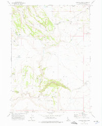
1973 Map of Wagon Box Basin
USGS Topo · Published 1976About this map
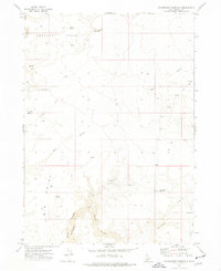
Wagon Box Basin and the surrounding high desert of Owyhee County are defined here by a network of vital water sources and remote cattle ranching infrastructure. The landscape is punctuated by numerous named springs such as Marmaduke Spring and Sam Noble Spring, alongside the CCC Spring which points to earlier twentieth-century conservation efforts in the region. The map captures the isolated nature of the terrain, where landmarks like Spencer Butte and Avery Table provided navigation points for those moving through Toy Valley Creek or along the rugged drainage of Camas Creek. Traces of human presence are sparse but significant, notably the Johnston Cabin in the eastern reaches and various reservoirs like Bullhead Reservoir and D Bar Reservoir that sustained livestock. This 1973 survey illustrates a classic Western rangeland, where life and movement were dictated entirely by the locations of springs and seasonal creeks.
Find a feature on this map
32 named features on this map. Tap any name to fly to it.
Don’t see what you’re looking for? This feature index may not catch every label — zoom into the map to look around manually.
Map Details
Editions of this 1973 Wagon Box Basin Map
This is the sole edition of this map. No revisions or reprints were ever made.
Other maps of this area

1955 · Jordan Valley
USGS Topo · 1:250,000

1957 · Jordan Valley
USGS Topo · 1:250,000

1958 · Jordan Valley
USGS Topo · 1:250,000
1972 · Frying Pan Basin
USGS Topo · 1:24,000
1972 · Big Springs Ranch
USGS Topo · 1:24,000
1972 · Clover Mtn
USGS Topo · 1:24,000

1973 · Castro Table
USGS Topo · 1:24,000

1973 · Hurry Up Creek
USGS Topo · 1:24,000

1973 · Wickiup Creek
USGS Topo · 1:24,000
1973 · Dickshooter Reservoir
USGS Topo · 1:24,000