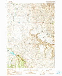
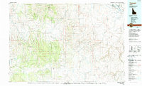
1990 Map of Triangle Reservoir
USGS Topo · Published 1991About this map
The settlement of Triangle serves as a small anchor for this 1990 survey of Idaho's high desert, characterized by a complex network of springs and seasonal water sources. The landscape is defined by the prominent Antelope Ridge and the broad reach of Cow Valley, where numerous natural water points like Stagecoach Spring and Antelope Spring supported life and livestock. The area's hydrology is further detailed through features such as Triangle Reservoir and the White Horse Reservoir, which manage the flow of creeks like North Fork Castle Creek and Louise Creek. A labyrinth of 4wd routes crisscrosses the terrain, indicating the practical, rugged transit methods required to navigate the gulches and ridges. This map captures the region's ranching and wilderness character, highlighting the critical importance of specific water locations such as Buckaroo Spring and Toy Seep in an arid environment.
Find a feature on this map
25 named features on this map. Tap any name to fly to it.
Don’t see what you’re looking for? This feature index may not catch every label — zoom into the map to look around manually.
Map Details
Editions of this 1990 Triangle Reservoir Map
This is the sole edition of this map. No revisions or reprints were ever made.
Other maps of this area

1955 · Jordan Valley
USGS Topo · 1:250,000

1957 · Jordan Valley
USGS Topo · 1:250,000

1958 · Jordan Valley
USGS Topo · 1:250,000

1965 · Triangle
USGS Topo · 1:62,500
1972 · Pixley Basin
USGS Topo · 1:24,000
1972 · Antelope Spring
USGS Topo · 1:24,000
1972 · Clover Mtn
USGS Topo · 1:24,000

1973 · Hurry Up Creek
USGS Topo · 1:24,000

1973 · Wickiup Creek
USGS Topo · 1:24,000
1990 · Triangle
USGS Topo · 1:100,000