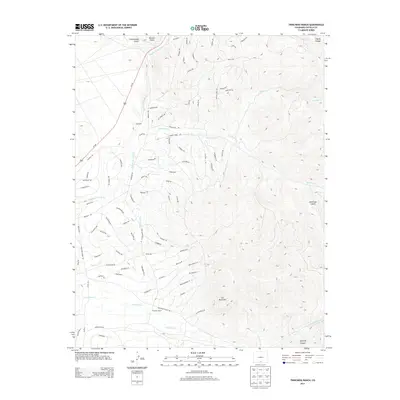
2013 Map of Trinchera Ranch
USGS Topo · Published 2013About this map
Trinchera Ranch and the small settlement of Mortimer anchor this 2013 U.S. Geological Survey topographic study of the high-elevation terrain in Costilla County. The landscape is defined by the complex drainage systems of Trinchera Cr and the Sangre de Cristo Cr, which flow through deep canyons and gulches. Evidence of water management is visible via the Indian Cr Ditch, reflecting the necessity of irrigation in this arid upland environment. The survey also details the climb to Cat Mountain and the surrounding high-country geography, including Coyote Canyon and American Gulch. A dense network of local roads such as Miller Rd and Beekman Rd provides access to the ranching and mountainous areas, while Us-160 cuts across the western portion of the quadrangle.
Find a feature on this map
91 named features on this map. Tap any name to fly to it.
Don’t see what you’re looking for? This feature index may not catch every label — zoom into the map to look around manually.
Map Details
Editions of this 2013 Trinchera Ranch Map
This is the sole edition of this map. No revisions or reprints were ever made.
Other maps of this area

1889 · Huerfano Park
USGS Topo · 1:125,000

1892 · Huerfano Park
USGS Topo · 1:125,000

1954 · Trinidad
USGS Topo · 1:250,000

1955 · Trinidad
USGS Topo · 1:250,000

1958 · Trinidad
USGS Topo · 1:250,000

1959 · Trinidad
USGS Topo · 1:250,000

1963 · Mc Carty Park
USGS Topo · 1:24,000

1963 · La Veta Pass
USGS Topo · 1:24,000

1967 · Fort Garland SW
USGS Topo · 1:24,000

1967 · Ojito Peak
USGS Topo · 1:24,000