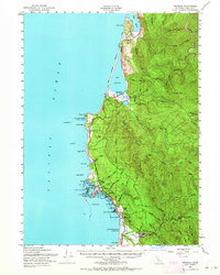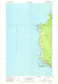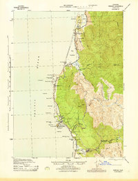
1945 Map of Trinidad
USGS Topo · Published 1945About this map
Trinidad sits prominently on this Pacific coastline, serving as a hub for both maritime activity and regional maintenance during the mid-1940s. The presence of the U S Coast Guard Headquarters and the Trinidad Head Lighthouse emphasizes the importance of this harbor, while the Highway Maint Sta nearby marks its role as a land-based transit point. Inland, the landscape is defined by a network of timber and agricultural operations, from the Adams Fox Farm to various family-named holdings like the Peugh Ranch and Reimann Ranch.
Find a feature on this map
74 named features on this map. Tap any name to fly to it.
Don’t see what you’re looking for? This feature index may not catch every label — zoom into the map to look around manually.
Map Details
Editions of this 1945 Trinidad Map
This is the sole edition of this map. No revisions or reprints were ever made.
Historical Maps of McKinleyville Through Time
7 maps found