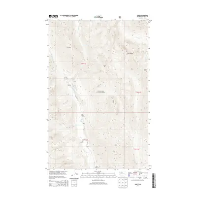
2014 Map of Trinity
USGS Topo · Published 2014About this map
The settlement of Trinity serves as a lone outpost within the high-elevation reach of the Wenatchee National Forest, situated where the Chiwawa River meets the drainages of Phelps Cr and James Cr. This 2014 survey reveals a landscape primarily defined by its recreational infrastructure and dramatic elevation changes, with the Chiwawa River Rd providing access to a string of forest service sites including Atkinson Flat Campground, Nineteenmile Campground, and Maple Creek Campground. To the east, the Entiat Mountains rise sharply, punctuated by landmarks such as Old Gib Mtn and Carne Mtn. The map traces the intricate water network feeding the river, including Little Giant Cr and Maple Cr, alongside high-altitude crossings like Pomas Pass at the edge of the t30n r17e boundary.
Find a feature on this map
29 named features on this map. Tap any name to fly to it.
Don’t see what you’re looking for? This feature index may not catch every label — zoom into the map to look around manually.
Map Details
Editions of this 2014 Trinity Map
This is the sole edition of this map. No revisions or reprints were ever made.
Other maps of this area

1901 · Chiwaukum
USGS Topo · 1:125,000

1902 · Stehekin
USGS Topo · 1:125,000

1904 · Stehekin
USGS Topo · 1:125,000

1904 · Chiwaukum
USGS Topo · 1:125,000

1944 · Holden
USGS Topo · 1:62,500

1944 · Lucerne
USGS Topo · 1:62,500

1949 · Lucerne
USGS Topo · 1:62,500

1949 · Holden
USGS Topo · 1:62,500

1955 · Concrete
USGS Topo · 1:250,000

1957 · Wenatchee
USGS Topo · 1:250,000