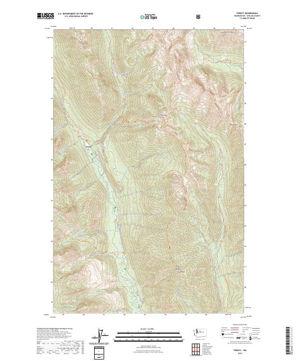
2023 Map of Trinity
USGS Topo · Published 2023About this map
Trinity sits at the heart of this high-elevation landscape, where the Chiwawa River carves a deep valley through the eastern Cascades. This modern 2023 survey documents the extensive network of trails and ridges within the Glacier Peak Wilderness and the Wenatchee National Forest. The map detail follows the steep rise from the river basin to prominent summits like Carne Mtn, Old Gib Mtn, and the jagged Spectacle Buttes. An intricate system of routes, including the Phelps Ridge Trl and Rock Creek Trl, provides access to remote points like Pomas Pass. The land is defined by the Entiat Mountains and drainage systems from Phelps Creek and Little Giant Creek, illustrating the complex topography used by hikers and outdoor researchers to navigate the high country of Chelan County.
Find a feature on this map
38 named features on this map. Tap any name to fly to it.
Don’t see what you’re looking for? This feature index may not catch every label — zoom into the map to look around manually.
Map Details
Editions of this 2023 Trinity Map
This is the sole edition of this map. No revisions or reprints were ever made.
Other maps of this area

1901 · Chiwaukum
USGS Topo · 1:125,000

1902 · Stehekin
USGS Topo · 1:125,000

1904 · Stehekin
USGS Topo · 1:125,000

1904 · Chiwaukum
USGS Topo · 1:125,000

1944 · Holden
USGS Topo · 1:62,500

1944 · Lucerne
USGS Topo · 1:62,500

1949 · Lucerne
USGS Topo · 1:62,500

1949 · Holden
USGS Topo · 1:62,500

1955 · Concrete
USGS Topo · 1:250,000

1957 · Wenatchee
USGS Topo · 1:250,000