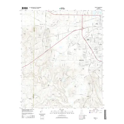
2014 Map of Trinity
USGS Topo · Published 2014About this map
The western suburbs of Decatur and the rural communities of Morgan and Lawrence counties define this landscape. Expanding residential areas like Griffin Addition and Austinville sit adjacent to established industrial and transport corridors, including the Gordon Terry Pky and Al-20. To the west, the terrain rises into prominent elevations such as Jackson Mtn and Trinity Mtn, while the northern edge is bounded by the expansive waters of Wheeler Lake.
Find a feature on this map
119 named features on this map. Tap any name to fly to it.
Don’t see what you’re looking for? This feature index may not catch every label — zoom into the map to look around manually.
Map Details
Editions of this 2014 Trinity Map
This is the sole edition of this map. No revisions or reprints were ever made.
Other maps of this area

1888 · Cullman
USGS Topo · 1:125,000

1888 · Huntsville
USGS Topo · 1:125,000

1892 · Cullman
USGS Topo · 1:125,000

1892 · Huntsville
USGS Topo · 1:125,000

1935 · Danville
USGS Topo · 1:48,000

1935 · Oakville
USGS Topo · 1:24,000

1936 · Caddo
USGS Topo · 1:24,000

1936 · Hartselle
USGS Topo · 1:24,000

1936 · Decatur
USGS Topo · 1:24,000

1936 · Stewart Cross Roads
USGS Topo · 1:24,000