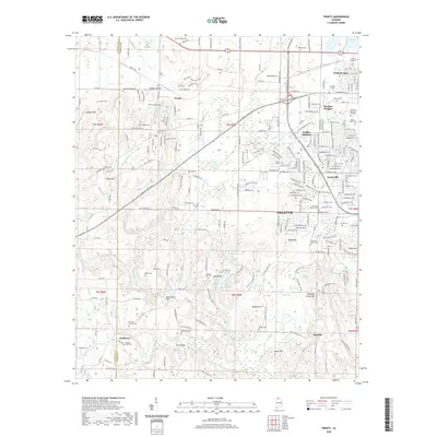
2020 Map of Trinity
USGS Topo · Published 2020About this map
The boundary between Lawrence and Morgan Counties runs through this landscape where the Tennessee River's Wheeler Lake defines the northern edge. The area showcases a transition from the urban expansion of Decatur, including neighborhoods like Austinville, Griffin Addition, and West Decatur, into the more rural terrains of Trinity and Wolftown. Genealogists will find a high concentration of burial grounds, including the Bellview Church Cem, Mount Zion Cem, and the historic Dancy-Garth Cem near Moulton Heights. The Norfolk Southern railroad cuts across the territory, connecting these communities and following the path of the Gordon Terry Pkwy. To the south, the topography rises toward Chestnut Grove Mtn and Trinity Mtn, overlooking significant water features such as Hamilton Lake and the winding West Flint Creek.
Find a feature on this map
246 named features on this map. Tap any name to fly to it.
Don’t see what you’re looking for? This feature index may not catch every label — zoom into the map to look around manually.
Map Details
Editions of this 2020 Trinity Map
This is the sole edition of this map. No revisions or reprints were ever made.
Other maps of this area

1888 · Cullman
USGS Topo · 1:125,000

1888 · Huntsville
USGS Topo · 1:125,000

1892 · Cullman
USGS Topo · 1:125,000

1892 · Huntsville
USGS Topo · 1:125,000

1935 · Danville
USGS Topo · 1:48,000

1935 · Oakville
USGS Topo · 1:24,000

1936 · Caddo
USGS Topo · 1:24,000

1936 · Hartselle
USGS Topo · 1:24,000

1936 · Decatur
USGS Topo · 1:24,000

1936 · Stewart Cross Roads
USGS Topo · 1:24,000