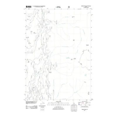
2011 Map of Tripod Peak
USGS Topo · Published 2011About this map
Tripod Peak Lookout stands as a prominent high point within the West Mountains of Gem County, anchoring a landscape defined by its complex drainage systems and high-elevation meadows. This 2011 survey details the upper reaches of Squaw Creek and its many tributaries, including the Second Fork Squaw Creek and Third Fork Squaw Creek. The map documents numerous named locations such as Tamarack Flat and Greenfield Flat, while distinctive landmarks like Hangman Tree and Gabes Bathtub provide unique points of interest for local historians. A network of Forest Service roads, including Snowbank Mountain Rd and NFD 625 Rd, traces the ridges and valleys, illustrating the infrastructure used to manage these uplands between Buck Mountain and Snowbank Mountain.
Find a feature on this map
37 named features on this map. Tap any name to fly to it.
Don’t see what you’re looking for? This feature index may not catch every label — zoom into the map to look around manually.
Map Details
Editions of this 2011 Tripod Peak Map
This is the sole edition of this map. No revisions or reprints were ever made.
Other maps of this area

1894 · Squaw Creek
USGS Topo · 1:125,000

1911 · Meadows
USGS Topo · 1:125,000

1953 · Smiths Ferry
USGS Topo · 1:62,500

1954 · Council
USGS Topo · 1:62,500

1954 · Cascade
USGS Topo · 1:62,500

1955 · Baker
USGS Topo · 1:250,000

1959 · Baker
USGS Topo · 1:250,000

1970 · Dodson Pass
USGS Topo · 1:24,000
1970 · Twin Sisters
USGS Topo · 1:24,000

1980 · McCall
USGS Topo · 1:100,000