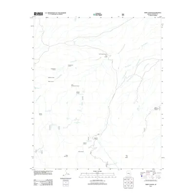
2011 Map of Tripp Canyon
USGS Topo · Published 2011About this map
Cedar Mountain and Blue Jay Ridge anchor this arid landscape in Graham County, where the terrain is defined by a complex network of canyons and washes. The naming conventions throughout the quadrangle, such as Sawmill Canyon and Two Troughs Canyon, suggest a history of local resource management and livestock grazing. This is further evidenced by the high density of water catchments including Ladrone Tank, Otto Tank, and the Dry Lake Stock Tank. These features, alongside Two Troughs Spring and Sawmill Spring, were essential for sustaining life and industry in a region where water is the primary geographic constraint. Modern access is represented by Tripp Canyon Rd, which follows the namesake Tripp Canyon through the eastern portion of the study area.
Find a feature on this map
43 named features on this map. Tap any name to fly to it.
Don’t see what you’re looking for? This feature index may not catch every label — zoom into the map to look around manually.
Map Details
Editions of this 2011 Tripp Canyon Map
This is the sole edition of this map. No revisions or reprints were ever made.
Other maps of this area

1940 · Sierra Bonita Ranch
USGS Topo · 1:62,500

1942 · Sierra Bonita Ranch
USGS Topo · 1:62,500

1942 · Mt. Graham
USGS Topo · 1:62,500

1943 · Sierra Bonita Ranch
USGS Topo · 1:62,500

1944 · Jackson Mtn.
USGS Topo · 1:62,500

1945 · Mt. Graham
USGS Topo · 1:62,500

1946 · Jackson Mtn.
USGS Topo · 1:62,500

1954 · Silver City
USGS Topo · 1:250,000

1956 · Tucson
USGS Topo · 1:250,000

1958 · Silver City
USGS Topo · 1:250,000