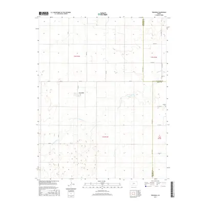
2015 Map of Trousdale
USGS Topo · Published 2015About this map
Trousdale sits at the intersection of several local routes in this modern survey of south-central Kansas. The township boundaries of t25s r16w and t26s r16w define a landscape dominated by the winding path of Rattlesnake Cr. This stream meanders through the sandy, depression-filled terrain typical of the Great Bend Prairie, creating a complex pattern of wetlands and low-lying basins.
Find a feature on this map
26 named features on this map. Tap any name to fly to it.
Don’t see what you’re looking for? This feature index may not catch every label — zoom into the map to look around manually.
Map Details
Editions of this 2015 Trousdale Map
This is the sole edition of this map. No revisions or reprints were ever made.
Other maps of this area
1889 · Kinsley
USGS Topo · 1:125,000
1892 · Kinsley
USGS Topo · 1:125,000
1892 · Pratt
USGS Topo · 1:125,000
1894 · Kinsley
USGS Topo · 1:125,000
1894 · Pratt
USGS Topo · 1:125,000
1955 · Pratt
USGS Topo · 1:250,000
1959 · Pratt
USGS Topo · 1:250,000
1968 · Cullison
USGS Topo · 1:24,000
1968 · Haviland NW
USGS Topo · 1:24,000
1968 · Haviland NE
USGS Topo · 1:24,000