1971 Map of Trousdale
USGS Topo · Published 1974About this map
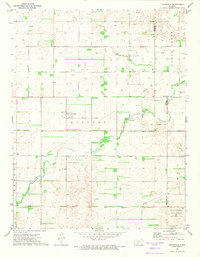
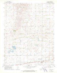
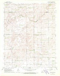
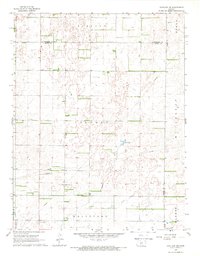
Trousdale sits at the heart of this early 1970s landscape, positioned near a network of infrastructure that tells the story of early Kansas development and resource extraction. The area is defined by a significant Oil and Gas Field and a network of Pipelines, reflecting the industrial importance of the region at this time. Evidence of former transportation routes is preserved through the Railroad Grade and Old RR Grade that cut across the prairie, while the Old Indian Treaty Boundary marks an important historical division in the land's administration. Natural features like Rattlesnake Creek and Clear Creek provide the primary drainage for the surrounding plains, including the expansive Pratt Sandhills State Wildlife Management Area. Local history is anchored by the Prattsburg Cem and Hopewell Cem, which remain as essential landmarks for genealogical research.
Find a feature on this map
19 named features on this map. Tap any name to fly to it.
Don’t see what you’re looking for? This feature index may not catch every label — zoom into the map to look around manually.
Map Details
Editions of this 1971 Trousdale Map
This is the sole edition of this map. No revisions or reprints were ever made.
Other maps of this area

1889 · Kinsley
USGS Topo · 1:125,000

1892 · Kinsley
USGS Topo · 1:125,000

1892 · Pratt
USGS Topo · 1:125,000

1894 · Kinsley
USGS Topo · 1:125,000

1894 · Pratt
USGS Topo · 1:125,000

1955 · Pratt
USGS Topo · 1:250,000

1959 · Pratt
USGS Topo · 1:250,000
1968 · Cullison
USGS Topo · 1:24,000
1968 · Haviland NW
USGS Topo · 1:24,000
1968 · Haviland NE
USGS Topo · 1:24,000