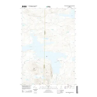
2014 Map of Trout Brook Mountain
USGS Topo · Published 2014About this map
Grand Lake Matagamon dominates the central landscape of this territory, where the waters are punctuated by Louse Island and hemmed in by significant elevations like Trout Brook Mountain and Horse Mtn. This high-country watershed serves as a vital drainage for the North Maine Woods, with the East Branch Penobscot River flowing south through a valley defined by Birch Point and the slopes of Hay Mtn.
Find a feature on this map
32 named features on this map. Tap any name to fly to it.
Don’t see what you’re looking for? This feature index may not catch every label — zoom into the map to look around manually.
Map Details
Editions of this 2014 Trout Brook Mountain Map
This is the sole edition of this map. No revisions or reprints were ever made.
Other maps of this area

1954 · Shin Pond
USGS Topo · 1:62,500

1954 · Millinocket Lake
USGS Topo · 1:62,500

1954 · Grand Lake Seboeis
USGS Topo · 1:62,500

1954 · Presque Isle
USGS Topo · 1:250,000

1955 · Traveler Mountain
USGS Topo · 1:62,500

1958 · Presque Isle
USGS Topo · 1:250,000

1960 · Presque Isle
USGS Topo · 1:250,000
1975 · The Traveler
USGS Topo · 1:24,000
1975 · Shin Pond SW
USGS Topo · 1:24,000
1975 · Shin Pond NW
USGS Topo · 1:24,000