
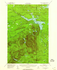
1955 Map of Traveler Mountain
USGS Topo · Published 1956About this map
Traveler Mountain and the surrounding wilderness of Baxter State Park dominate this mid-century landscape, capturing a region defined by its logging history and conservation efforts. The map reveals a transition from industrial logging to public recreation, centered around Grand Lake Matagamon and its infrastructure, including Grand Lake Dam and the Norway Dam. Historic outposts such as Trout Brook Farm and Black Brook Farm provide evidence of the area's agricultural past in support of timber operations.
Find a feature on this map
124 named features on this map. Tap any name to fly to it.
Don’t see what you’re looking for? This feature index may not catch every label — zoom into the map to look around manually.
Map Details
Editions of this 1955 Traveler Mountain Map
4 editions found
Other maps of this area

1927 · Katahdin
USGS Topo · 1:48,000

1930 · Katahdin
USGS Topo · 1:62,500

1949 · Katahdin
USGS Topo · 1:62,500

1953 · Telos Lake
USGS Topo · 1:62,500

1953 · Stacyville
USGS Topo · 1:62,500

1954 · Spider Lake
USGS Topo · 1:62,500

1954 · Harrington Lake
USGS Topo · 1:62,500

1954 · Shin Pond
USGS Topo · 1:62,500

1954 · Millinocket Lake
USGS Topo · 1:62,500

1954 · Grand Lake Seboeis
USGS Topo · 1:62,500