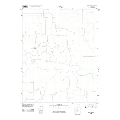
2010 Map of Trout Creek
USGS Topo · Published 2010About this map
The Cimarron River meanders across this prairie landscape in Comanche County, shaping the local geography as it flows through the western Kansas plains. This 2010 survey highlights a sparse, rural environment where water sources and isolated infrastructure define the settlement patterns. Civil aviation is represented by Shupe Airport, situated on the northern side of the river valley. The map details a network of vital waterways feeding into the main river system, including the winding paths of Bluff Creek, Snake Creek, and the curiously named Trout. To the south and east, Willow Creek and Day Creek further illustrate the drainage patterns of this high plains region, providing critical orientation points for researchers and local historians studying the natural and man-made features of the area.
Find a feature on this map
7 named features on this map. Tap any name to fly to it.
Don’t see what you’re looking for? This feature index may not catch every label — zoom into the map to look around manually.
Map Details
Editions of this 2010 Trout Creek Map
This is the sole edition of this map. No revisions or reprints were ever made.
Other maps of this area

1892 · Coldwater
USGS Topo · 1:125,000

1894 · Sitka
USGS Topo · 1:62,500

1896 · Ashland
USGS Topo · 1:125,000

1955 · Woodward
USGS Topo · 1:250,000

1955 · Pratt
USGS Topo · 1:250,000

1958 · Woodward
USGS Topo · 1:250,000

1959 · Pratt
USGS Topo · 1:250,000

1970 · Selman NW
USGS Topo · 1:24,000

1970 · Buffalo NW
USGS Topo · 1:24,000

1970 · Buffalo NE
USGS Topo · 1:24,000