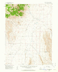
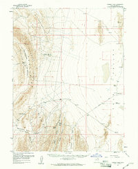
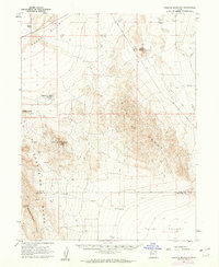
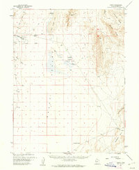
1961 Map of Trout Creek
USGS Topo · Published 1963About this map
The high desert valley of Gandy Valley is defined by its vital water sources in this mid-century survey. Small settlements like Partoun and the namesake Trout Creek cling to the alluvial fans where streams such as Birch Creek emerge from the high ground of the Deep Creek Range. The landscape is a study in survival, with numerous isolated water points including Coyote Spring, Trough Spring, and Blue Spring serving as critical landmarks for travelers on the unpaved Gandy Road.
Find a feature on this map
49 named features on this map. Tap any name to fly to it.
Don’t see what you’re looking for? This feature index may not catch every label — zoom into the map to look around manually.
Map Details
Editions of this 1961 Trout Creek Map
This is the sole edition of this map. No revisions or reprints were ever made.
Other maps of this area

1908 · Fish Springs
USGS Topo · 1:250,000

1910 · Fish Springs
USGS Topo · 1:250,000

1953 · Delta
USGS Topo · 1:250,000

1956 · Ely
USGS Topo · 1:250,000

1958 · Delta
USGS Topo · 1:250,000

1959 · Ely
USGS Topo · 1:250,000
1959 · Cowboy Pass
USGS Topo · 1:62,500
1960 · Granite Mountain
USGS Topo · 1:62,500
1960 · Gandy
USGS Topo · 1:62,500

1962 · Delta
USGS Topo · 1:250,000