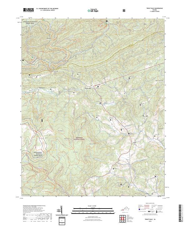
2022 Map of Trout Dale
USGS Topo · Published 2022About this map
Jefferson National Forest dominates this section of Grayson County, where the high ridges of the Blue Ridge Mountains create a complex hydrological landscape. The Tennessee Valley Divide snakes through the center of the sheet, separating waters that flow toward the Atlantic from those destined for the Tennessee River system. Small upland settlements like Trout Dale and Fairwood are situated along these ancient drainage routes, connected by a network of forest roads and historic paths including the Appalachian National Scenic Trail.
Find a feature on this map
122 named features on this map. Tap any name to fly to it.
Don’t see what you’re looking for? This feature index may not catch every label — zoom into the map to look around manually.
Map Details
Editions of this 2022 Trout Dale Map
This is the sole edition of this map. No revisions or reprints were ever made.
Other maps of this area

1889 · Wytheville
USGS Topo · 1:125,000

1891 · Abingdon
USGS Topo · 1:125,000

1892 · Wytheville
USGS Topo · 1:125,000

1894 · Abingdon
USGS Topo · 1:125,000

1909 · Abingdon
USGS Topo · 1:96,000

1911 · Abingdon
USGS Topo · 1:125,000

1931 · Rural Retreat
USGS Topo · 1:48,000

1935 · Mouth of Wilson
USGS Topo · 1:48,000

1935 · Park
USGS Topo · 1:24,000

1935 · Mount Rogers
USGS Topo · 1:48,000