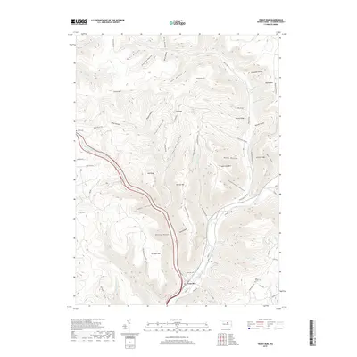
2019 Map of Trout Run
USGS Topo · Published 2019About this map
Lycoming Creek snakes through a deep valley in this section of the Appalachian Plateaus, anchoring the local settlements of Gray and Trout Run. The terrain is defined by a dense network of high ridges and hollows, where family-named features like Cochran Mtn, Cornwell Mtn, and Hanlon Mtn stand above deep drainages. The naming of Splash Dam Run suggests the area's legacy of timber management, where water was once harnessed to move logs through the steep landscape.
Find a feature on this map
75 named features on this map. Tap any name to fly to it.
Don’t see what you’re looking for? This feature index may not catch every label — zoom into the map to look around manually.
Map Details
Editions of this 2019 Trout Run Map
This is the sole edition of this map. No revisions or reprints were ever made.
Other maps of this area

1921 · Trout Run
USGS Topo · 1:62,500

1923 · Trout Run
USGS Topo · 1:62,500

1925 · Blossburg
USGS Topo · 1:62,500

1927 · Blossburg
USGS Topo · 1:62,500

1930 · Warrensville
USGS Topo · 1:62,500

1934 · Warrensville
USGS Topo · 1:62,500

1942 · Canton
USGS Topo · 1:62,500

1944 · Blossburg
USGS Topo · 1:62,500

1944 · Trout Run
USGS Topo · 1:62,500

1944 · Canton
USGS Topo · 1:62,500
Featured Places
- Lewis Township, PA
- Caldwell, Lewis Township
- Cogan House Township, PA
- McIntyre Township, PA
- Gamble Township, PA