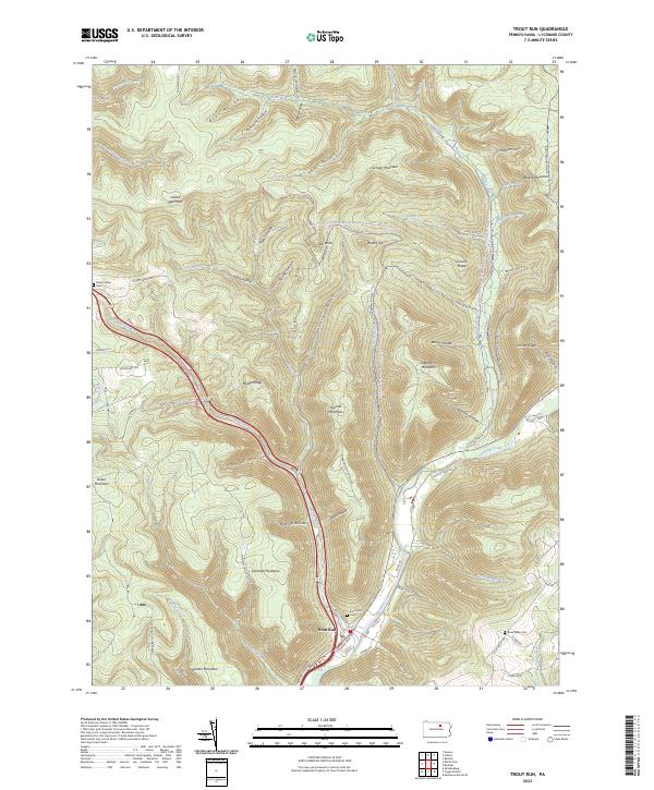
2023 Map of Trout Run
USGS Topo · Published 2023About this map
Trout Run occupies the confluence where its namesake watercourse joins Lycoming Creek, serving as a central hub for the surrounding ridges of Lycoming County. The terrain is characterized by a dense network of hollows, such as Yoder Hollow and Fourmile Hollow, which separate prominent elevations like Cochran Mountain and Cornwell Mountain. These landforms dictate the passage of modern infrastructure, with Steam Valley Run and the Loyalsock State Forest & Worlds End State Park Snowmobile Trails Trl navigating the steep valleys. Local history is anchored by several burial grounds, including Steam Valley Cem to the northwest and Rose Valley Cem in the southeast, while the winding Grays Run Rd follows the path of Grays Run through the high country.
Find a feature on this map
76 named features on this map. Tap any name to fly to it.
Don’t see what you’re looking for? This feature index may not catch every label — zoom into the map to look around manually.
Map Details
Editions of this 2023 Trout Run Map
This is the sole edition of this map. No revisions or reprints were ever made.
Other maps of this area

1921 · Trout Run
USGS Topo · 1:62,500

1923 · Trout Run
USGS Topo · 1:62,500

1925 · Blossburg
USGS Topo · 1:62,500

1927 · Blossburg
USGS Topo · 1:62,500

1930 · Warrensville
USGS Topo · 1:62,500

1934 · Warrensville
USGS Topo · 1:62,500

1942 · Canton
USGS Topo · 1:62,500

1944 · Blossburg
USGS Topo · 1:62,500

1944 · Trout Run
USGS Topo · 1:62,500

1944 · Canton
USGS Topo · 1:62,500
Featured Places
- Jackson Township, PA
- Lewis Township, PA
- Caldwell, Lewis Township
- Gray, Lewis Township
- Cogan House Township, PA