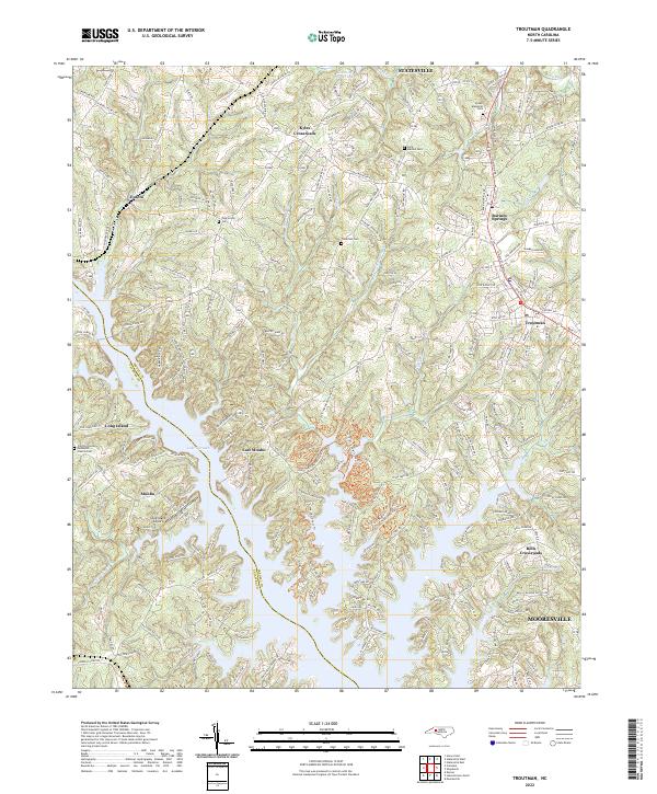
2022 Map of Troutman
USGS Topo · Published 2022About this map
Lake Norman dominates the southern reaches of this Iredell County landscape, its sprawling fingers creating a complex shoreline that separates communities like Monbo and East Monbo. The terrain is defined by a transition from the dense residential and recreational developments along the water to the traditional crossroads settlements further inland. To the north and east, the town of Troutman and the community of Barium Springs sit along a corridor of historical development, punctuated by long-established sites such as Saint Martins Cem and Troutman Cem.
Find a feature on this map
231 named features on this map. Tap any name to fly to it.
Don’t see what you’re looking for? This feature index may not catch every label — zoom into the map to look around manually.
Map Details
Editions of this 2022 Troutman Map
This is the sole edition of this map. No revisions or reprints were ever made.
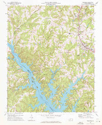
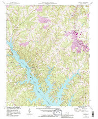
Historical Maps of Statesville Through Time
3 maps found