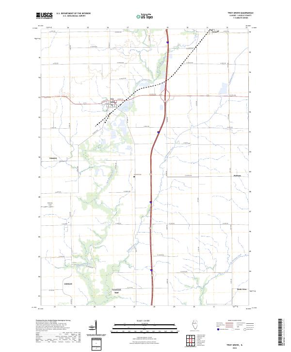
2024 Map of Troy Grove
USGS Topo · Published 2024About this map
Troy Grove is the central hub of this agricultural landscape in LaSalle County, where the intersection of N 37th Rd and Ottawa St anchors the small community. The terrain is defined by a dense network of watercourses, including the Little Vermilion River and Vermilion Creek, which cut through the fertile prairie. Further south, the elevation rises at Tomahawk Bluff near the drainage of Tomahawk Creek, providing a distinct topographic break from the surrounding grid of farm roads.
Find a feature on this map
43 named features on this map. Tap any name to fly to it.
Don’t see what you’re looking for? This feature index may not catch every label — zoom into the map to look around manually.
Map Details
Editions of this 2024 Troy Grove Map
This is the sole edition of this map. No revisions or reprints were ever made.
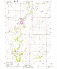
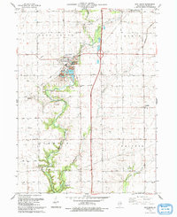
Historical Maps of Triumph Through Time
3 maps found