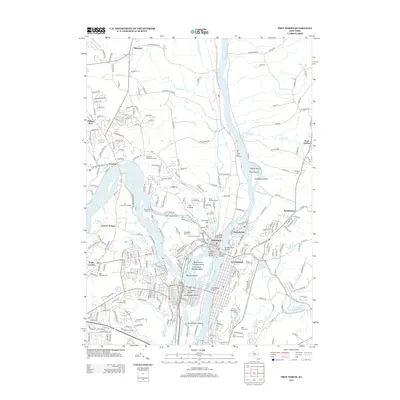
2013 Map of Troy North
USGS Topo · Published 2013About this map
The Hudson River and Mohawk River converge in a complex network of islands and historic waterways at the heart of this Capital District study. The landscape is defined by its industrial and navigational history, featuring the Old Champlain Canal and several significant river crossings near Waterford. To the south, the densely settled neighborhoods of Lansingburgh give way to prominent landforms like Prospect Hill and the sprawling grounds of Oakwood Cem. Numerous historic burial grounds are clustered throughout the area, including Waterford Rural Cem, Saint Michaels Cem, and Saint Josephs Cem, providing valuable points of reference for genealogists. The map also details the interconnected islands of the delta, such as Van Schaick Island, Peebles Island, and Simmons Island, where early transport and water power infrastructure once thrived.
Find a feature on this map
92 named features on this map. Tap any name to fly to it.
Don’t see what you’re looking for? This feature index may not catch every label — zoom into the map to look around manually.
Map Details
Editions of this 2013 Troy North Map
This is the sole edition of this map. No revisions or reprints were ever made.
Other maps of this area

1893 · Cohoes
USGS Topo · 1:62,500

1893 · Troy
USGS Topo · 1:62,500

1893 · Schenectady
USGS Topo · 1:62,500

1893 · Albany
USGS Topo · 1:62,500

1895 · Troy
USGS Topo · 1:62,500

1895 · Cohoes
USGS Topo · 1:62,500

1895 · Albany
USGS Topo · 1:62,500

1895 · Schenectady
USGS Topo · 1:62,500

1898 · Schenectady
USGS Topo · 1:62,500

1898 · Albany
USGS Topo · 1:62,500