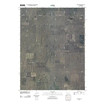
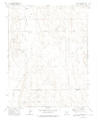
2010 Map of Truckton
USGS Topo · Published 2010About this map
Truckton serves as the primary orientation point for this high plains landscape of El Paso County, characterized by an orderly grid of rural roads and scattered homesteads. The topography is relatively level, marked by intermittent drainage patterns and distinctive landmarks like the prominent Signal Rock in the northwest. Transportation and accessibility in this ranching area are defined by a network of gravel and paved routes, including Lauppe Rd, Boone Rd, and Edison Rd. Near the southern boundary, the Foxx Valley Ranch Airport indicates the role of private aviation in managing these large territorial holdings. The map records a quiet corner of the Colorado plains, where local nomenclature such as Night Train Ln and Heavenly Vw suggests the individual character of rural developments and ranch access roads during the early 21st century.
Find a feature on this map
19 named features on this map. Tap any name to fly to it.
Don’t see what you’re looking for? This feature index may not catch every label — zoom into the map to look around manually.
Map Details
Editions of this 2010 Truckton Map
This is the sole edition of this map. No revisions or reprints were ever made.
Other maps of this area

1893 · Big Springs
USGS Topo · 1:125,000

1954 · Pueblo
USGS Topo · 1:250,000

1957 · Pueblo
USGS Topo · 1:250,000

1958 · Pueblo
USGS Topo · 1:250,000

1962 · Pueblo
USGS Topo · 1:250,000

1966 · Pueblo
USGS Topo · 1:250,000
1973 · Hanover NE
USGS Topo · 1:24,000
1973 · Truckton
USGS Topo · 1:24,000
1973 · Truckton SE
USGS Topo · 1:24,000
1973 · Hanover SE
USGS Topo · 1:24,000