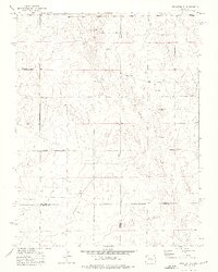
1973 Map of Truckton SE
USGS Topo · Published 1975About this map
Four Colorado counties—El Paso, Lincoln, Pueblo, and Crowley—converge in this high plains landscape surveyed in the early 1970s. The terrain is characterized by a network of rural routes named for local families, including Neely Road and Myers Road in the northern reaches, and Whittemore Road and Rasner Road further south. This area represents a sparsely populated transition zone where land management and livestock operations appear as the primary human footprint on the land.
Find a feature on this map
9 named features on this map. Tap any name to fly to it.
Don’t see what you’re looking for? This feature index may not catch every label — zoom into the map to look around manually.
Map Details
Editions of this 1973 Truckton SE Map
2 editions found
Other maps of this area

1889 · Sanborn
USGS Topo · 1:125,000

1891 · Sanborn
USGS Topo · 1:125,000

1891 · Catlin
USGS Topo · 1:125,000

1891 · Nepesta
USGS Topo · 1:125,000

1893 · Nepesta
USGS Topo · 1:125,000

1893 · Sanborn
USGS Topo · 1:125,000

1893 · Big Springs
USGS Topo · 1:125,000

1893 · Catlin
USGS Topo · 1:125,000

1904 · Nepesta
USGS Topo · 1:125,000

1954 · Lamar
USGS Topo · 1:250,000