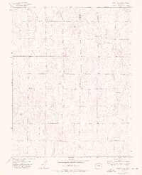
1973 Map of Truckton NE
USGS Topo · Published 1976About this map
The high plains along the boundary of El Paso and Lincoln Counties appear as a landscape of rural endurance in the early 1970s. The area is defined by a rhythmic grid of sectional roads, including Truckton Road and Shear Road, which cut across the subtle drainage of Pond Creek. This corner of Colorado is sparsely populated, with the most significant gathering point being the St Lukes Cem, a quiet landmark for local families. The presence of numerous wells and intermittent water features emphasizes the agricultural reliance on groundwater in this part of the state. The layout of Whittemore Road and Johnson Road reflects a strictly organized land division typical of the eastern plains, where every mile marker often corresponds to a family name or a vital junction for the surrounding homesteads.
Find a feature on this map
10 named features on this map. Tap any name to fly to it.
Don’t see what you’re looking for? This feature index may not catch every label — zoom into the map to look around manually.
Map Details
Editions of this 1973 Truckton NE Map
2 editions found
Other maps of this area

1889 · Sanborn
USGS Topo · 1:125,000

1891 · Sanborn
USGS Topo · 1:125,000

1893 · Sanborn
USGS Topo · 1:125,000

1893 · Big Springs
USGS Topo · 1:125,000

1954 · Lamar
USGS Topo · 1:250,000

1954 · Pueblo
USGS Topo · 1:250,000

1957 · Pueblo
USGS Topo · 1:250,000

1958 · Pueblo
USGS Topo · 1:250,000

1958 · Lamar
USGS Topo · 1:250,000

1962 · Pueblo
USGS Topo · 1:250,000