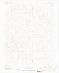
1973 Map of Truckton NE
USGS Topo · Published 1976About this map
The high plains of the El Paso Co Lincoln Co boundary define this landscape in the early 1970s. This survey records a network of established section roads and family-named routes, including Whittemore Road, Johnson Road, and Keller Road, which crisscross the prairie terrain. The drainage of Pond Creek and several isolated basins, simply labeled Pond, provide the primary relief in an area characterized by scattered agricultural development and ranching operations.
Find a feature on this map
11 named features on this map. Tap any name to fly to it.
Don’t see what you’re looking for? This feature index may not catch every label — zoom into the map to look around manually.
Map Details
Editions of this 1973 Truckton NE Map
2 editions found
Other maps of this area

1889 · Sanborn
USGS Topo · 1:125,000

1891 · Sanborn
USGS Topo · 1:125,000

1893 · Sanborn
USGS Topo · 1:125,000

1893 · Big Springs
USGS Topo · 1:125,000

1954 · Lamar
USGS Topo · 1:250,000

1954 · Pueblo
USGS Topo · 1:250,000

1957 · Pueblo
USGS Topo · 1:250,000

1958 · Pueblo
USGS Topo · 1:250,000

1958 · Lamar
USGS Topo · 1:250,000

1962 · Pueblo
USGS Topo · 1:250,000