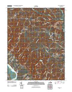
2011 Map of Truhart
USGS Topo · Published 2011About this map
King and Queen Court House serves as a historic focal point in this 2011 record of rural Virginia, situated along the western edge of a landscape defined by its complex hydrology. The map illustrates a network of extensive wetland systems, including Exol Swamp, Dragon Swamp, and Holmes Swamp, which dictate the placement of roads and small crossroads settlements. These communities, such as Carlton Corner, Dragonville, and Truhart, are connected by narrow routes like Liberty Hall Rd and Truhart Rd that skirt the swamp edges. Along the Mattaponi River in the southwest, riverfront locations like Melrose Landing and Davis Beach reflect a different orientation toward the water, while interior features like Exol Cemetery and Allens Millpond provide specific points of interest for local history and genealogical research. The naming conventions, featuring labels like Allen Shop Corner, suggest a landscape rooted in long-standing property lines and local landmarks.
Find a feature on this map
45 named features on this map. Tap any name to fly to it.
Don’t see what you’re looking for? This feature index may not catch every label — zoom into the map to look around manually.
Map Details
Editions of this 2011 Truhart Map
This is the sole edition of this map. No revisions or reprints were ever made.
Other maps of this area

1917 · Urbanna
USGS Topo · 1:62,500

1917 · Morattico
USGS Topo · 1:62,500

1918 · Tappahannock
USGS Topo · 1:62,500

1918 · Morattico
USGS Topo · 1:62,500

1919 · New Kent
USGS Topo · 1:62,500

1919 · Tappahannock
USGS Topo · 1:62,500

1926 · Morattico
USGS Topo · 1:62,500

1943 · Richmond
USGS Topo · 1:250,000

1944 · Dunnsville
USGS Topo · 1:31,680

1944 · Morattico
USGS Topo · 1:31,680